RelatioNet Maps
Data |
Tools@People |
Maps |
Netzer |
Yad Vashem |

Map server - http://mapy.mk.cvut.cz
...I tried to collect some maps which are more difficult to get. They cover whole world and they are in digital form... With cooperation with other folks and searching on Internet this collection incredibly raised during last few months. Nowadays the data volume on this server is 19GB!
מכיל מפות מיוחדות בהם בק"מ 1:50000 וגם תצאו"ת ממקומות שונים בעולם
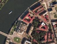
מתוך האתר: תצ"א של הרובע היהודי בפרג
1. Eastern Mediteranean Overview
2. War of Independence, 15 May - 10 June 1948 - Arab Attacks
3. War of Independence, October 1948 Battles
4. War of Indepemdence, 22 December 1948 - 7 January 1949, OPERATION AYIN
5. Opening Phase, 29 - 31 October 1956, Opening Moves
6. Conquest of Sinai, 1 - 5 November 1956
7. The Penetrations, 5 - 6 June 1967
8. Conquest of Sinai, 7 - 8 June 1967
9. The Jordan Salient, 5 - 7 June 1967
10. Battle of Golan Heights, 9 - 10 June 1967
11. The Golan Heights Campaign, 6 - 12 October 1973
12. Suez Canal Area, Egyptian Attacks/ Israeli Counteratacks 6 - 15 October 1973
13. Suez Canal Area, OPERATION GAZELLE, 15 - 23 October 1973


Map of Anders Army path, from "An Army in Exile", scanned by Zbyszek Styrna
Africa_camps
Album: Kresy mapsChanged: Jul 23, 2004. Contains: 9 items.
Album: Poland's 2nd Republic maps (1921-1939)See also http://www.aforgottenodyssey.com/ks/Maps/Ordering_Poland_1920-30s_Maps/1.Poland1921-1939.pptChanged: Aug 03, 2003. Contains: 6 items.
Album: Soviet labour camp mapsMaps of GULAG slave labour and camps and prisons in Siberia, Kazakhstan, and throughout the Soviet UnionChanged: Dec 14, 2004. Contains: 7 items.
Album: GaliciaMaps provided by Mark TerechChanged: Dec 07, 2003. Contains: 18 items.

http://www.mapquest.com/maps/main.adp?countrycode=247
http://www.atlapedia.com/
http://www.Expediamaps.com/
http://www.omnimap.com/catalog
http://www.embassyworld.com/maps/maps.html
http://embassy.countrywatch.com/cw_country.asp?vCOUNTRY=116
Galicia:
http://www.jewishgen.org/Galicia/towns/maps.html
http://lazarus.elte.hu/hun/digkonyv/topo/3felmeres.htm
Belarus:
http://www.jewishgen.org/Belarus/resources.htm#top
http://www.multimap.com/map/places.cgi?overviewmap=BY&client=europe
Lithuania:
http://www.jewishgen.org/litvak/images/prewarlith.jpg
http://www.multimap.com/map/places.cgi?overviewmap=LT&client=europe
Moldova:
http://www.multimap.com/map/places.cgi?overviewmap=MD&client=europe
Poland:
http://www.pilot.pl
http://www.multimap.com/map/places.cgi?overviewmap=PL&client=europe
Ukraine:
http://www.multimap.com/map/places.cgi?overviewmap=UA&client=europe
http://www.lib.berkeley.edu/EART/x-ussr/ukraine.html
http://www.infoukes.com/ua-maps/others/


Scale of 1:2,700,000 or one 1 inch = approximately 42 miles)"
Austria - 304K - Austria, Styria and Tyrol
Banat - 155K - Central Hungary - Banat Region*
Bohemia - 138K - Bohemia
Galicia - 238K - Galicia
Moravia - 95K - Moravia
Northern Hungary* - 185K - Northern Hungary
Eastern Hungary - Transylvania* - 139K Eastern Hungary
Western Hungary* - 148K - Western Hungary


• Poland Maps on other sites
• Volhynia Maps on other sites
• Poland and Volhynia Maps on other sites
• East Prussia Maps and an old Germany village locator on other sites


Auschwitz Environs
Camps for Displaced Persons in Germany and Austria
The Defeat of Nazi Germany
Deportations to Killing Centers in Occupied Poland
The Destruction of Synagogues on Kristallnacht
“Euthanasia” Centers
The Evacuation of Nazi Camps and the Death Marches of Prisoners
Extermination Camps in Poland
German Occupied Europe
Ghettos in Occupied Europe
Ghettos in Poland
Jewish Armed Resistance in Eastern Europe
Jewish Communities in Germany, Austria, and Czechoslovakia
Jewish Emigration From Germany 1933-1939
Jewish Population of Europe Before the Holocaust
Jewish Resistance in Ghettos and Camps
The Liberation of Major Nazi Camps
Major Concentration and Death Camps
Mobile Killing Squad (Einsatzgruppen) Massacres in Eastern Europe
Nazi Camps in Greater Germany 1944
Nazi Camps in Occupied Europe 1943-1944
The Persecution of Roma (Gypsies)
Rescue in Budapest
The Rescue of Danish Jews
Rescue and Escape from German-Occupied Europe
Trials of War Criminals in Europe
The Voyage of the SS St. Louis
The Wannsee Conference in Berlin
The Warsaw Ghetto
Westerbork Camp
Self-Pronouncing Map of the Nazi Camp System. Click on this interactive map for descriptions and pronunciations of the major camps.
Expulsions. Map of Jewish expulsions and resettlement areas in Europe, 1100-1500.
Pogroms. Map of pogroms and antisemitic acts of violence in Russia and the Pale from 1871-1906.
Emancipation of European Jewry. Map of Europe showing the date of the emancipation of Jews by country from 1789 to 1930.
Kristallnacht. Map of the Nazi violence against Jewish synagogues, November 9, 1938.
Jewish Population of Europe, 1939. Map of Europe showing the total Jewish population of each country in 1939.
Bialystok Ghetto, April 2, 1943. Over 50,000 people lived in the Bialystok Ghetto at the end of 1941. The (eastern) boundary of the ghetto was Sienkiewicz Street, renamed on the map as "Erich Koch Street."
Bialystok Ghetto Revolt. August 16, 1943, was the beginning of an armed revolt in the Bialystok ghetto prepared by the United Anti-Fascist Bloc (Communists, Dror, Hashomer Hatsair, and the Bund).
Six Major Death Camps. Map of the six major death camps in occupied Poland.
Dachau. Map of Dachau, the first Nazi concentration camp located in Southern Germany.
Auschwitz. Map of the Auschwitz concentration camp located in what is now Poland.
Treblinka. Map of Treblinka showing locations of buildings at former extermination camp. Adapted from a sign at the memorial site.
Westerbork Transit Camp. Until July 1942, Westerbork was a refuge camp for Jews who had moved illegally to the Netherlands. After the Nazi conquest of Holland, it was operated as a transit camp until April 1944.
Europe before 1919. Map of Europe showing Germany and Austria-Hungary before the Treaty of Versailles. Choice of color map for display on computer screen (left) or blackline master in PDF format for printing (right).
Territory lost after the 1919 Treaty of Versailles. Map showing territory lost by Germany and Austria-Hungary after the First World War. Choice of color map for display on computer screen (left) or blackline master in PDF format for printing (right).
Demilitarized Zone-Treaty of Versailles. Map of Germany and Austria-Hungary after the Treaty of Versailles marking the demilitarized zone. Choice of color map for display on computer screen or blackline master in PDF format for printing (right).
Europe after 1919. Map of Europe after the Treaty of Versailles (1919). Choice of color map for display on computer screen (left) or blackline master in PDF format for printing (right).
Kristallnacht. Map plotting concentrated areas of Nazi violence against Jews during the infamous "Kristallnacht". Choice of color map for display on computer screen (left) or blackline master in PDF format for printing (right).
Central Europe 1939. Map showing: the Sudetenland, the new protectorate of Bohemia-Moravia, and how Poland was divided after its invasion. Choice of color map for display on computer screen (left) or blackline master in PDF format for printing (right).
Greater Germany 1942. Map of Greater Germany in November of 1942 showing territories annexed by the Reich. Choice of color map for display on computer screen (left) or blackline master in PDF format for printing (right).
Ghettos in Europe. Map showing Jewish ghettos in Europe under the Nazis. Choice of color map for display on computer screen (left) or blackline master in PDF format for printing (right).
The Warsaw Ghetto. Map of the Warsaw Ghetto in what is now Poland. Choice of color map for display on computer screen (left) or blackline master in PDF format for printing (right).
Railroads Leading to Auschwitz. Map of the rail system that brought victims to the Auschwitz concentration camp. Choice of color map for display on computer screen (left) or blackline master in PDF format for printing (right).
Nazi Camp System. Map of transit, concentration, and extermination camps in Europe. Choice of color map for display on computer screen (left) or blackline master in PDF format for printing (right).
Rescue of Danish Jews. Map plotting the rescue routes of Danish Jews. Choice of color map for display on computer screen (left) or blackline master in PDF format for printing (right).
Central Europe 1945. Map of Central Europe as it looked at the end of the war. Choice of color map for display on computer screen (left) or blackline master in PDF format for printing (right).
Central Europe Today. Map of Central Europe today. Blackline master in PDF format.
Europe Today. Map of Europe today. Blackline master in PDF format.
|
|
Sunday, January 01, 2006
Wednesday, November 16, 2005
Directory of Cities and Towns in World
Directory of Cities and Towns in WorldWednesday, October 26, 2005
Map server - http://mapy.mk.cvut.cz מבחר מפות ותצאו"ת מיוחדות

Map server - http://mapy.mk.cvut.cz
...I tried to collect some maps which are more difficult to get. They cover whole world and they are in digital form... With cooperation with other folks and searching on Internet this collection incredibly raised during last few months. Nowadays the data volume on this server is 19GB!
מכיל מפות מיוחדות בהם בק"מ 1:50000 וגם תצאו"ת ממקומות שונים בעולם
מתוך האתר: תצ"א של הרובע היהודי בפרג
Albanie-Albania/ Armenie-Armenia/ Azerbajdzan-Azerbaijan/ Bulharsko-Bulgaria/ Centr._Asia/ Cesko-Czech Rep/ Cina-China/ Estonsko-Estonia/ Finsko-Finlandia/ Gruzie-Georgia/ Indie-India/ Italie-Italy/ Jugoslavie-Yugoslavia/ Kavkaz-Caucasus/ Litva-Lithuania/ Madarsko-Hungary/ Maroko-Morocco/ Mars Atlas/ Mongolsko-Mongolia/ Nemecko-Germany/ Nizozemi-Netherlands/ Peru/ Polsko-Poland/ Rakousko-Austria/ Recko-Greece/ Rumunsko-Romania/ Rusko-Russia/ Satelite_photos/ Slovensko-Slovakia/ Slovinsko-Slovenia/ Stredni_vychod-Middl..> Svycarsko-Swiss/ Traffic_maps/ Turecko-Turkey/ Ukrajina-Ukraine/ index to maps/
Sunday, October 23, 2005
Topographical Maps - scale 1:100,000 South-eastern corner of Poland
South-eastern corner of Poland Topographical Maps - scale 1:100,000These are high resolution [ 100,000 : 1 ] maps of the south-eastern corner of Poland, with a small encroachment into Ukraine and the Slovak Republic. These maps were recently released for public use by the Headquarters of the Polish Army, Carthographic Division, Warsaw 1994. Each centimeter corresponds to 1 kilometer, or 1 inch equals approximately 1.5 miles. Therefore on individual maps, the grid is 2 km x 2 km. Due to high resolution, each of these maps is about 300 kb in size, so you might wish to view these while at work or schule.
Sunday, June 19, 2005
arab israeli wars index
arab israeli wars index1. Eastern Mediteranean Overview
2. War of Independence, 15 May - 10 June 1948 - Arab Attacks
3. War of Independence, October 1948 Battles
4. War of Indepemdence, 22 December 1948 - 7 January 1949, OPERATION AYIN
5. Opening Phase, 29 - 31 October 1956, Opening Moves
6. Conquest of Sinai, 1 - 5 November 1956
7. The Penetrations, 5 - 6 June 1967
8. Conquest of Sinai, 7 - 8 June 1967
9. The Jordan Salient, 5 - 7 June 1967
10. Battle of Golan Heights, 9 - 10 June 1967
11. The Golan Heights Campaign, 6 - 12 October 1973
12. Suez Canal Area, Egyptian Attacks/ Israeli Counteratacks 6 - 15 October 1973
13. Suez Canal Area, OPERATION GAZELLE, 15 - 23 October 1973
Saturday, April 30, 2005
Eastern Slovakia Research Strategies
Eastern Slovakia Research Strategies המדריך האולטימטיבי- לחיפוש בסלובקיה
Thursday, April 07, 2005
Tuesday, March 08, 2005
Maps
Maps
Political Maps
Map of Galicia. From an 1882 historical atlas (FEEFHS web site).
Galician Administrative District Map (Polish Genealogical Society of America web site).
Austro-Hungarian Empire 1:200,000 Topographic Maps - Include most of Galicia and Bukovina. The sections of Galicia that include Lvov and Brody are missing. Warning: These maps are each over 4MB in size, so downloads can take a long time.
Ukraine 1:100,000 Topographic Maps - Maps of this detail are 1 inch = 19 miles (1 cm = 10 km). The maps are in Russian. Warning: a typical map is more over 1MB in size, so downloads can take a long time.
Town Maps
Lemberg (Lwow), from a 1905 Baedeker's Austria-Hungary. Note the "Old Jewish cemetery" ("Alter Isrealin Friedhof") on the D1/D2 border, and the Synagogue on the E1/E2 border.
Color [350K].
Krakau (Krakow), from a 1905 Baedeker's Austria-Hungary.
Color [200K].
Tuesday, September 14, 2004
AFO & Kresy-Siberia Photo Album :: Poland Maps
AFO & Kresy-Siberia Photo Album :: Maps
Map of Anders Army path, from "An Army in Exile", scanned by Zbyszek Styrna
Africa_camps
Album: Kresy mapsChanged: Jul 23, 2004. Contains: 9 items.
Album: Poland's 2nd Republic maps (1921-1939)See also http://www.aforgottenodyssey.com/ks/Maps/Ordering_Poland_1920-30s_Maps/1.Poland1921-1939.pptChanged: Aug 03, 2003. Contains: 6 items.
Album: Soviet labour camp mapsMaps of GULAG slave labour and camps and prisons in Siberia, Kazakhstan, and throughout the Soviet UnionChanged: Dec 14, 2004. Contains: 7 items.
Album: GaliciaMaps provided by Mark TerechChanged: Dec 07, 2003. Contains: 18 items.
Saturday, July 31, 2004

Tuesday, July 27, 2004
RTRFoundation
RTRFoundation
General:http://www.mapquest.com/maps/main.adp?countrycode=247
http://www.atlapedia.com/
http://www.Expediamaps.com/
http://www.omnimap.com/catalog
http://www.embassyworld.com/maps/maps.html
http://embassy.countrywatch.com/cw_country.asp?vCOUNTRY=116
Galicia:
http://www.jewishgen.org/Galicia/towns/maps.html
http://lazarus.elte.hu/hun/digkonyv/topo/3felmeres.htm
Belarus:
http://www.jewishgen.org/Belarus/resources.htm#top
http://www.multimap.com/map/places.cgi?overviewmap=BY&client=europe
Lithuania:
http://www.jewishgen.org/litvak/images/prewarlith.jpg
http://www.multimap.com/map/places.cgi?overviewmap=LT&client=europe
Moldova:
http://www.multimap.com/map/places.cgi?overviewmap=MD&client=europe
Poland:
http://www.pilot.pl
http://www.multimap.com/map/places.cgi?overviewmap=PL&client=europe
Ukraine:
http://www.multimap.com/map/places.cgi?overviewmap=UA&client=europe
http://www.lib.berkeley.edu/EART/x-ussr/ukraine.html
http://www.infoukes.com/ua-maps/others/
3rd Military Mapping Survey of Austria-Hungary Index sheet of the general map of Central Europe (1:200 000) The original sheets were published in 1910
III. katonai felmeres
Ukraine 1:100,000 topographic maps מפות טופוגרפיות 1:1000.000 אוקראינה
Ukraine 1:100,000 topographic maps
FEEFHS MAP ROOM-Austro-Hungarian Maps Austro-Hungarian Empire (Eight CA&GW maps - 1.4 MB)
FEEFHS MAP ROOM-Austro-Hungarian Maps
: "Austro-Hungarian Empire (Eight CA&GW maps - 1.4 MB)Scale of 1:2,700,000 or one 1 inch = approximately 42 miles)"
Austria - 304K - Austria, Styria and Tyrol
Banat - 155K - Central Hungary - Banat Region*
Bohemia - 138K - Bohemia
Galicia - 238K - Galicia
Moravia - 95K - Moravia
Northern Hungary* - 185K - Northern Hungary
Eastern Hungary - Transylvania* - 139K Eastern Hungary
Western Hungary* - 148K - Western Hungary
Monday, July 19, 2004
Europe Maps 1939', 40, 41, 42, 43. 44. 49 מפות אירופה בשנים
Europe Maps 1939', 40, 41, 42, 43. 44. 49
Sunday, July 11, 2004


Sunday, June 27, 2004
Sunday, June 13, 2004
SGGEE Villages and Maps
Map Resources on the SGGEE site
• Poland Maps on other sites
• Volhynia Maps on other sites
• Poland and Volhynia Maps on other sites
• East Prussia Maps and an old Germany village locator on other sites
Friday, June 11, 2004
Perry-Casta?eda Library Map Collection - UT Library Online
Perry-Casta?eda Library Map Collection - UT Library Online
Wednesday, June 09, 2004
Holocaust Maps Table of Contents
Jewish Virtual Library
Auschwitz Environs
Camps for Displaced Persons in Germany and Austria
The Defeat of Nazi Germany
Deportations to Killing Centers in Occupied Poland
The Destruction of Synagogues on Kristallnacht
“Euthanasia” Centers
The Evacuation of Nazi Camps and the Death Marches of Prisoners
Extermination Camps in Poland
German Occupied Europe
Ghettos in Occupied Europe
Ghettos in Poland
Jewish Armed Resistance in Eastern Europe
Jewish Communities in Germany, Austria, and Czechoslovakia
Jewish Emigration From Germany 1933-1939
Jewish Population of Europe Before the Holocaust
Jewish Resistance in Ghettos and Camps
The Liberation of Major Nazi Camps
Major Concentration and Death Camps
Mobile Killing Squad (Einsatzgruppen) Massacres in Eastern Europe
Nazi Camps in Greater Germany 1944
Nazi Camps in Occupied Europe 1943-1944
The Persecution of Roma (Gypsies)
Rescue in Budapest
The Rescue of Danish Jews
Rescue and Escape from German-Occupied Europe
Trials of War Criminals in Europe
The Voyage of the SS St. Louis
The Wannsee Conference in Berlin
The Warsaw Ghetto
Westerbork Camp

Tuesday, June 08, 2004
Gallery - Maps
Gallery - Maps
Self-Pronouncing Map of the Nazi Camp System. Click on this interactive map for descriptions and pronunciations of the major camps.
Expulsions. Map of Jewish expulsions and resettlement areas in Europe, 1100-1500.
Pogroms. Map of pogroms and antisemitic acts of violence in Russia and the Pale from 1871-1906.
Emancipation of European Jewry. Map of Europe showing the date of the emancipation of Jews by country from 1789 to 1930.
Kristallnacht. Map of the Nazi violence against Jewish synagogues, November 9, 1938.
Jewish Population of Europe, 1939. Map of Europe showing the total Jewish population of each country in 1939.
Bialystok Ghetto, April 2, 1943. Over 50,000 people lived in the Bialystok Ghetto at the end of 1941. The (eastern) boundary of the ghetto was Sienkiewicz Street, renamed on the map as "Erich Koch Street."
Bialystok Ghetto Revolt. August 16, 1943, was the beginning of an armed revolt in the Bialystok ghetto prepared by the United Anti-Fascist Bloc (Communists, Dror, Hashomer Hatsair, and the Bund).
Six Major Death Camps. Map of the six major death camps in occupied Poland.
Dachau. Map of Dachau, the first Nazi concentration camp located in Southern Germany.
Auschwitz. Map of the Auschwitz concentration camp located in what is now Poland.
Treblinka. Map of Treblinka showing locations of buildings at former extermination camp. Adapted from a sign at the memorial site.
Westerbork Transit Camp. Until July 1942, Westerbork was a refuge camp for Jews who had moved illegally to the Netherlands. After the Nazi conquest of Holland, it was operated as a transit camp until April 1944.
Europe before 1919. Map of Europe showing Germany and Austria-Hungary before the Treaty of Versailles. Choice of color map for display on computer screen (left) or blackline master in PDF format for printing (right).
Territory lost after the 1919 Treaty of Versailles. Map showing territory lost by Germany and Austria-Hungary after the First World War. Choice of color map for display on computer screen (left) or blackline master in PDF format for printing (right).
Demilitarized Zone-Treaty of Versailles. Map of Germany and Austria-Hungary after the Treaty of Versailles marking the demilitarized zone. Choice of color map for display on computer screen or blackline master in PDF format for printing (right).
Europe after 1919. Map of Europe after the Treaty of Versailles (1919). Choice of color map for display on computer screen (left) or blackline master in PDF format for printing (right).
Kristallnacht. Map plotting concentrated areas of Nazi violence against Jews during the infamous "Kristallnacht". Choice of color map for display on computer screen (left) or blackline master in PDF format for printing (right).
Central Europe 1939. Map showing: the Sudetenland, the new protectorate of Bohemia-Moravia, and how Poland was divided after its invasion. Choice of color map for display on computer screen (left) or blackline master in PDF format for printing (right).
Greater Germany 1942. Map of Greater Germany in November of 1942 showing territories annexed by the Reich. Choice of color map for display on computer screen (left) or blackline master in PDF format for printing (right).
Ghettos in Europe. Map showing Jewish ghettos in Europe under the Nazis. Choice of color map for display on computer screen (left) or blackline master in PDF format for printing (right).
The Warsaw Ghetto. Map of the Warsaw Ghetto in what is now Poland. Choice of color map for display on computer screen (left) or blackline master in PDF format for printing (right).
Railroads Leading to Auschwitz. Map of the rail system that brought victims to the Auschwitz concentration camp. Choice of color map for display on computer screen (left) or blackline master in PDF format for printing (right).
Nazi Camp System. Map of transit, concentration, and extermination camps in Europe. Choice of color map for display on computer screen (left) or blackline master in PDF format for printing (right).
Rescue of Danish Jews. Map plotting the rescue routes of Danish Jews. Choice of color map for display on computer screen (left) or blackline master in PDF format for printing (right).
Central Europe 1945. Map of Central Europe as it looked at the end of the war. Choice of color map for display on computer screen (left) or blackline master in PDF format for printing (right).
Central Europe Today. Map of Central Europe today. Blackline master in PDF format.
Europe Today. Map of Europe today. Blackline master in PDF format.
|
The RelatioNet Project |

|

RelatioNet Maps is a part of the RelatioNet project an international collaborative project of harnessing the Internet for reunion of family branches that lost each other during WW2 and the holocaust.
Help
Previous Posts
- Ukrainian Road Map מפת דרכים אוקראינה
- Directory of Cities and Towns in World
- Map server - http://mapy.mk.cvut.cz מבחר מפות ותצא...
- Topographical Maps - scale 1:100,000 South-eastern...
- Map Collection אוסף המפות של הצי האמריקאי
- arab israeli wars index
- Galicia & Bukowina map
- Eastern Slovakia Research Strategies
- Galicia Map
- MAPS OF UKRAINE
Search RelatioNet Tools & People
- Don't see what you're looking for on this page? Search for it in the archives.
Archives
- June 2004
- July 2004
- September 2004
- March 2005
- April 2005
- June 2005
- October 2005
- November 2005
- January 2006
